
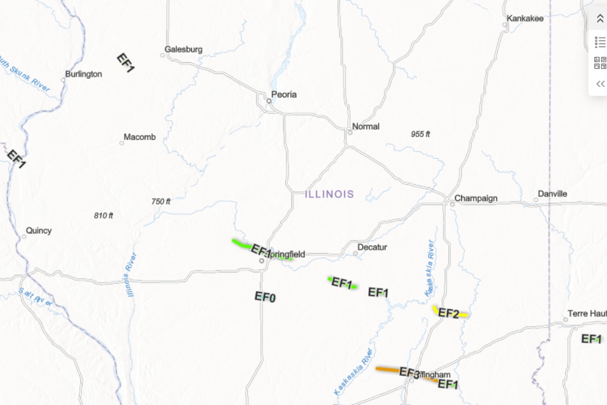
Lincoln, IL (CAPITOL CITY NOW) – The National Weather Service (NWS) says the severe weather of this past Wednesday caused the second tornado to hit Springfield in a week. And, it was the first of seven to hit Central Illinois that night.
The NWS Lincoln office has completed storm surveying following the storms of Wednesday. A total of seven tornadoes his the region, including two Wednesday morning that were part of a morning round of storms. The afternoon round started with an EF-1 tornado took a path that, forecasters say, was almost identical to the one that caused damage at Abraham Lincoln Capital Airport and the Animal Protective League Wednesday, June 10. The June 17 tornado, NWS says, “began in southern Menard County and tracked east-southeast just north of the Springfield (Abraham Lincoln) Capital Airport,” said a NWS social media post. “It continued along a very similar path as the June 10 tornado, ending on the west side of Mechanicsburg.”
It was spotted, according to storm reports, around 4:40 p.m. Wednesday, but did not cause major damage in Springfield. Power poles were reported down east of Dawson, and golf ball-sized hail was reported west of Illiopolis. It had estimated peak winds of 100 miles per hour and travelled 24 miles.
An EF-0 tornado was reported near Pawnee on Interstate 55 later in the evening around 6:48 p.m., with its strongest winds near 85 miles per hour, travelling less than six miles.
An EF-1 tornado just after 5:00 p.m., with maximum winds near 110 miles per hour, caused part of the roof to come off at Meridian Elementary School in Blue Mound, also destroying two grain bins.
But the worst of the tornadoes was an EF-3 near Effingham with 150 miles per hour max winds, causing considerable damage. An EF-2 tornado near Mattoon caused damage there and in Charleston, where officials declared a state of emergency at one point.
Among the other storms were two in western Illinois near Quincy, and one near Monmouth that caused damage in the downtown area of the Warren County seat and derailed several cars of a freight train.
A lesser possibility of severe weather is possible Sunday, but the greater concern, according to NWS, is heavy rain, with a Flood Watch in effect then. Anywhere from one to three inches of rain is possible with storms then.